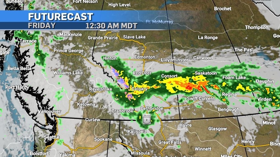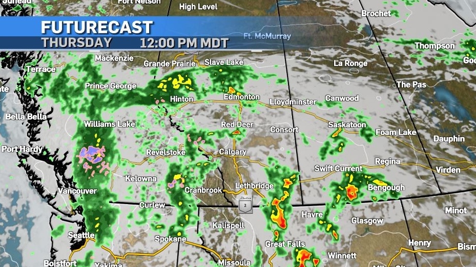


In what is looking to be one of those “perfect storm” scenarios, a low pressure system moving in to Alberta has already prompted rainfall warnings along the northern edge of the Rockies.
According to Environment and Climate Change Canada (ECCC), “heavy rain is expected tonight and Thursday, with total amounts of 50 to 80 mm.”
The weather agency notes some areas – including locations south of Highway 11, will see rain begin Thursday afternoon.
While rain is desperately needed in much of the province, all natural surface areas have a limited capacity to absorb water, and once that maximum saturation level is reached, excess moisture must find an alternative place to go – often resulting in localized flooding or possible flash flooding.
This is one of the concerns with this incoming system – as forecast rainfall totals are getting higher the closer we get to Thursday.
As that low crosses the mountains it is expected to stall out briefly – partially due to the physical barrier of the mountains to the west and also because it will be inhibited from travelling east due to the larger synoptic setup in Ontario and the Maritimes.

Between the counter-clockwise circulation around the low, and the persistent source of moisture from the Pacific, rainfall totals will be high – however it is important to remember upsloping scenarios are very difficult to pinpoint precipitation totals for.
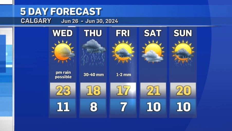
Calgary is likely to record at least 30 millimetres of rain – with the bulk of it starting Thursday afternoon.
Preceding this system, and along the outer edges of it, convective activity is likely as the incoming low works to push out the ridge of high pressure draping the southern border. Strong winds will impact southern Alberta as early as Wednesday afternoon, and intense thunderstorms may develop, including a risk of damaging winds and large-sized hail.

Temperatures will return to seasonal by the weekend, with the rain expected to ease off Friday in Calgary.
