

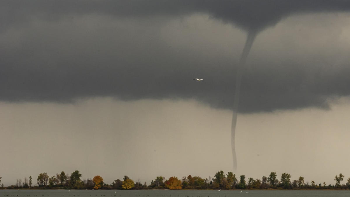
We’re heading into waterspout season across the lower Great Lakes, and this weekend will see the perfect set-up for waterspout formation.
A waterspout is a rotating column of air and mist. They can form during “fair” weather or during severe thunderstorms.

This weekend’s waterspout potential will not necessarily be generated by severe thunderstorms, but instead by an upper level low.
MUST SEE: Chasing ‘the most elusive weather’: Whimsical waterspouts
A strong upper level low will intensify over the Great Lakes, dragging in cold air aloft. We could even see some lake-effect rain showers mixed in with the wrap-around through the weekend.
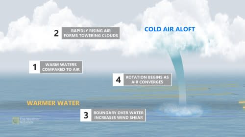

Wrap-around, cold northwesterly winds blowing over the relatively warm waters of the lakes will generate some instability below, rapidly growing cumulus clouds. This setup typically sees waterspouts developing from the bottom – up, rather than from the top – down, as is the case with severe storms.
The air and mist begin to rotate on the water’s surface, and become drawn upward to meet the cloud base with the fast rising air (updraft) beneath the cloud. They are usually short-lived.
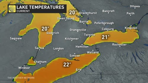

During the late summer and early fall are prime times to see waterspouts, as cooler air begins to settle in, but the lake temperatures are still quite warm. This creates a temperature gradient and instability between the air and lake surface, causing the air to rise rapidly, even outside of the presence of thunderstorms.
Waterspouts tend to be slow-moving or near stationary, but sometimes move onshore, where they can cause minor damage or injury. It is best to keep an eye on the weather warnings in your area, and adjust any outdoor plans accordingly.
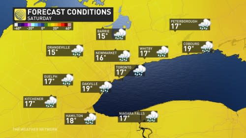

High temperatures across southern Ontario will be in the mid-teens this weekend, several degrees below normal, certainly giving an autumnal-like chill.
Thumbnail image courtesy: Malcolm Park