

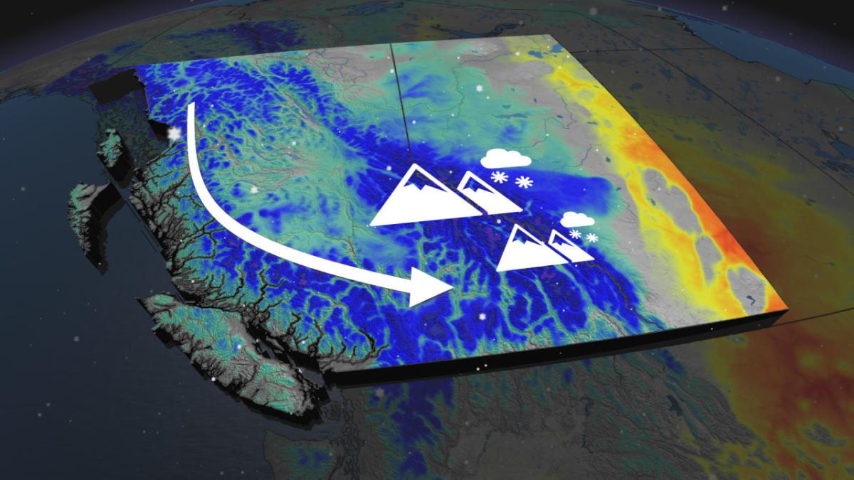
A bout of heavy rain swinging through Alberta will be replaced with a cooldown and even some snow in higher elevations.
With the cooler trough, precipitation will fall as snowfall in elevations as low as 1800 metres Tuesday night and Wednesday. Parts of the Rockies could see up to 30 cm of snowfall.
DON’T MISS: 30 cm of snow in August? It’s possible in Alberta’s Rockies
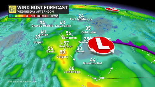
Temperatures will take a significant dive on Wednesday as winds pick up from the northwest. To make it feel worse, rain is expected to linger in parts of southern and central Alberta.
While wet snow was falling across the Rockies Tuesday afternoon, across southeastern Alberta temperatures were nearly 32 C including in Medicine Hat, Alta.

A quick shot of autumnal weather is expected in parts of southern Alberta Wednesday thanks to some cool, northwesterly winds. Temperatures fall sharply across the province on Wednesday as the rain will sink south to near Calgary.
Temperatures could also be cold enough for some folks to wake up Wednesday morning to some falling snow at Banff’s base.
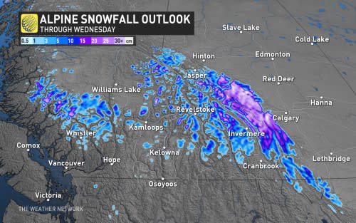

Areas across British Columbia such as Whistler, Revelstoke and the Okanagan connector have already seen late-summer flakes of snow on Tuesday.
The precipitation will last from Tuesday evening through Wednesday in the alpine, with up to 30 cm possible in the Alberta Rockies.
It will be rather blustery, as well, with sustained winds touching 50 km/h around the Edmonton area, with gusts approaching 80 km/h.

Temperatures will quickly rebound after the system departs, however, with warmer-than-seasonal temperatures spreading across the Prairies late week. A quick shot of cooler weather during the weekend, especially in the eastern sections, but then temperatures will rebound.
Conditions will turn hot for Labour Day and back to school, especially in Alberta and into Saskatchewan.
Stay with The Weather Network for the latest on your forecast across Alberta.