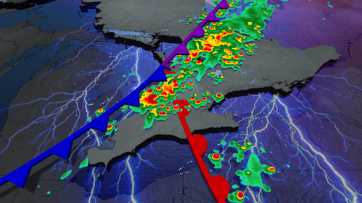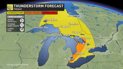


The start of the Labour Day long weekend could be a wet one for folks in southern Ontario on Friday. A series of fronts moving across the region will bring some severe storms to the region during the evening.
DON’T MISS: How the atmosphere bakes a perfect thunderstorm
Those around Lake Huron and Georgian Bay will be the most affected by these storms. The severity and impacts will depend on the timing of the system so it is important to keep an eye on the radar in your area, and stay alert for additional watches and warnings that may be issued.
A mesocyclone that is continuing its cross Canada tour will make its mark on southern Ontario on Friday, just in time for the long weekend.
Friday morning and early afternoon are looking nice and warm for a majority of the region, with temperatures in the mid-to-high 20’s. This will all take a turn towards the evening as a series of fronts move in, bringing the potential for severe weather.
A slow moving cluster of storms will impact those along Lake Huron and around the Georgian Bay area in the evening, bringing the threat of heavy downpours, strong winds and hail up to 2 cm in diameter.

The slow moving storms will make their way into the Greater Toronto Area (GTA) during the overnight hours, with heavy rainfall and the risk of frequent lightning.
The rain will clear out of region in time for Saturday, bringing sunny and warm temperatures for the rest of the long weekend.
There could be some potential for tornado activity, however this is dependent of the timing and the severity of the storms, so be sure to check back frequently as we continue to nail down our forecast.


Stay with The Weather Network for more forecast information and updates on your weather in Ontario.