

Extreme heat is expected to be the dominant weather story in Alberta and B.C. on Wednesday.
A very strong ridge of high pressure remains parked over the western portion of Canada and the United States, drawing in hot, humid air and pushing maximum temperatures as much as 10 to 13 C above average.
This system has been nearly stationary since the beginning of the week and is the reason dozens of maximum temperature records have been broken across Alberta and B.C. on Monday and Tuesday.
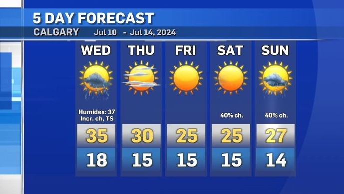
In Calgary, the forecast high on Wednesday is 35 C with a Humidex value of 37.
In Edmonton, the some models are forecasting highs of 37 C, and if that happens – and the temperatures creeps slightly higher than that – Edmonton would reach a new all-time daily high. The warmest temperature ever recorded in that city was 37.2 C on June 29, 1937.
Wednesday will be the day that this weather pattern starts to break down as an incoming frontal system enters the province from the north.
As it the new system moves in, there is an amplified risk of severe storm development when the cold dry air encounters the warm and humid air mass sitting over Alberta.
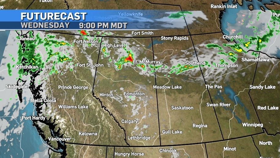
In a synoptic set-up known as a “ring of fire” storms are likely to develop around the outer edges of that high – with rapid intensification.
Wind gusts of up to 90 km/h are possible, as well as tennis ball-sized hail. Tornadic activity is not off the table as rotation is likely with some of these storms.

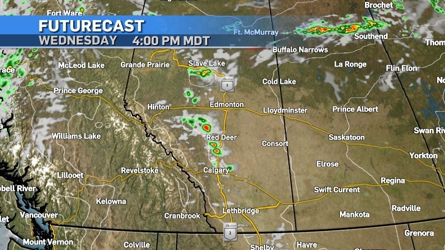
The most likely target area is in northern and central portions of our province later tonight but thunderstorms may also pop off the southern foothills today and impact areas as far south as Calgary in the mid-afternoon.

Daytime highs will start to moderate after Thursday, and overnight lows are also expected to cool slightly as we head in to the weekend.
