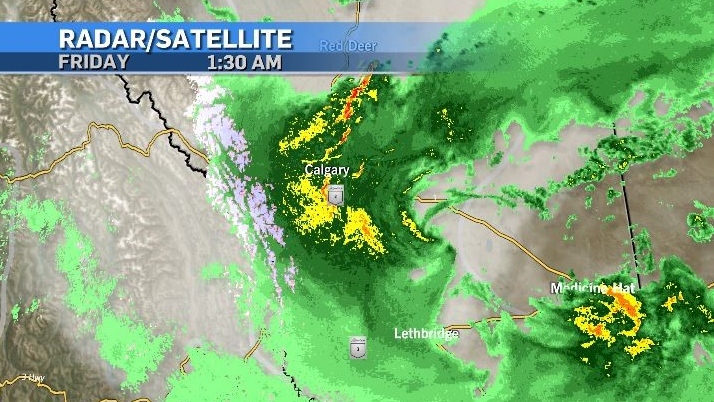


A much-needed break in active weather is expected for Friday. A persistent and moisture-laden low pressure system dumped significant amounts of rain in our province between Wednesday through Friday.
According to Environment and Climate Change Canada (ECCC), the hardest hit areas were in the east-central regions of our province with communities like Kirriemuir and Halkirk, recording 86 and 85 milimetres of rain respectively.
Locations along the foothills also saw notable amounts of rain.
Priddis reported 56 millimetres and Nordegg 52 millimetres.
Weather advisories, including rainfall warnings, funnel cloud advisories, severe thunderstorm watches and warnings and wind warnings preceded and corresponded to this system as it stalled out east of the mountains Thursday afternoon and evening.
Calgary was eventually also placed under a rainfall warning overnight as the final remnants of this system hammered the city.

As of 6:30 a.m. Friday, all weather advisories for Alberta had been dropped.
According to ECCC rainfall totals at YYC International (as of 6 a.m. Friday) reached 44 millimetres.
With both natural and manmade surfaces struggling to absorb such a large amount of moisture in such a short period of time, water could be found pooling in many areas during the Friday morning commute.
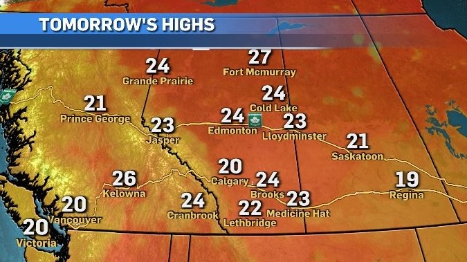
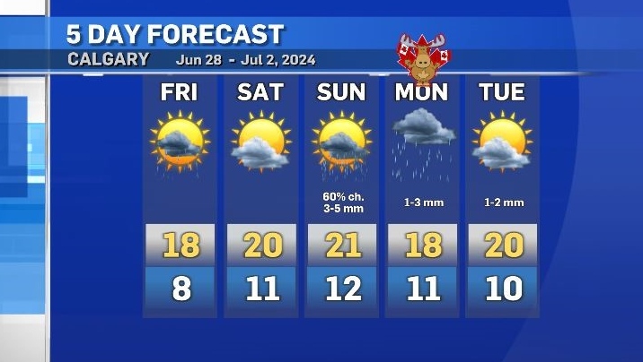
Saturday morning will likely bring foggy conditions for portions of the province due to overnight evaporation of saturated surface combined with minimal winds, but once that fog mixes out, sunshine will help drive daytime highs closer to seasonal throughout southern Alberta.

Mild conditions are expected to continue early Sunday with an increasing risk of showers and/or thunderstorms later in the day and continuing through to Monday for Canada Day.
Unlike the end of this past week, any potential accumulations at the start of next week will be minimal.
